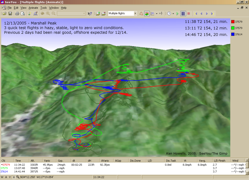
20051213: 3 Flights,
Marshall
Marshall
800 x 581
(401 KB)
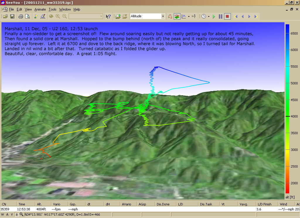
20051211: Marshall, 1 hr.
1024 x 744
(510 KB)
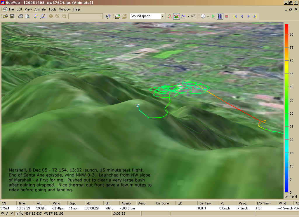
20051208: Marshall NW Launch
1024 x 744
(552 KB)

20051208: Marshall Entire (brief) Flight
1024 x 744
(608 KB)
20051121: Elsinore
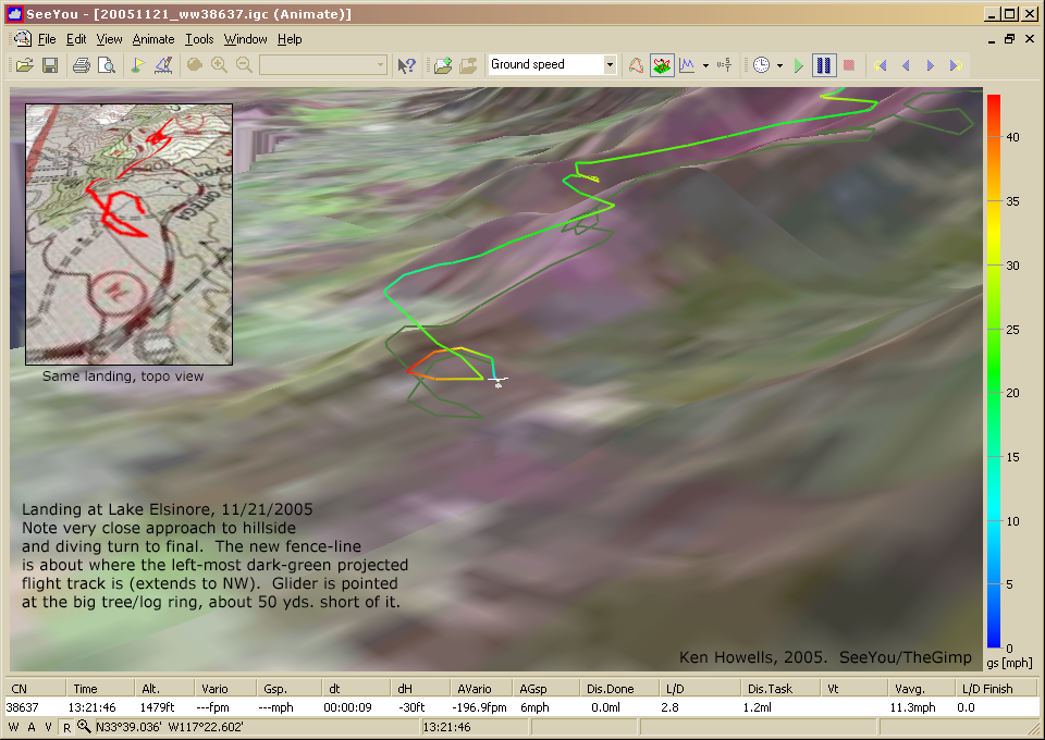
Close-up of Landing Approach
Close-up of Landing Approach
960 x 680
(579 KB)
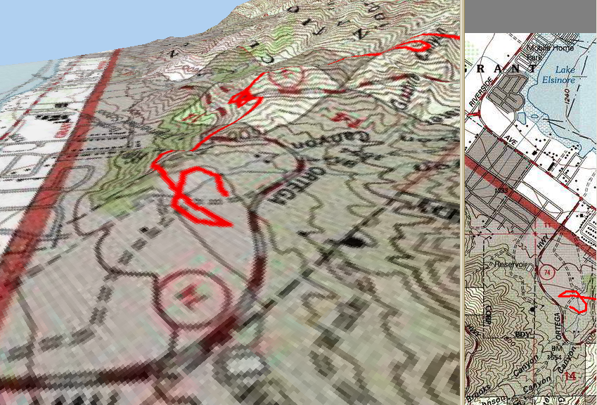
20051121: Landing at
Elsinore - 3D/2D Topo
Elsinore - 3D/2D Topo
849 x 576
(861 KB)
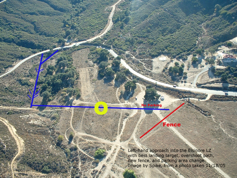
20051118: Elsinore
Approach & Fence
Depiction
by Spike
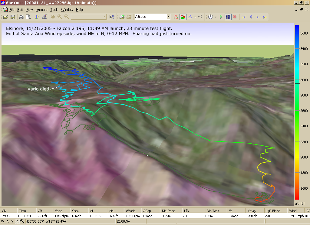
20051121: Elsinore
F2 195 #27996
Soaring
F2 195 #27996
Soaring
1024 x 744
(705 KB)
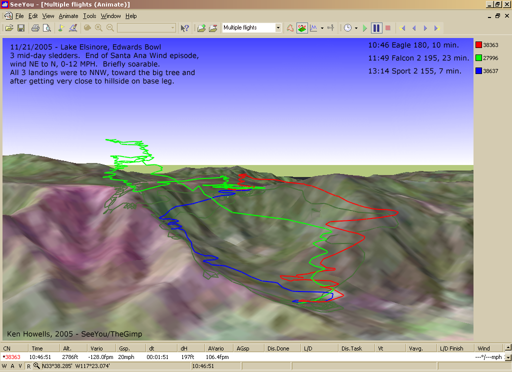
20051121: Elsinore
3 Test
Flights
3 Test
Flights
1024 x 744
(563 KB)
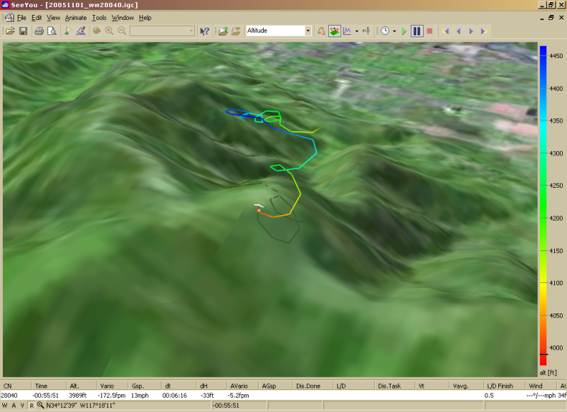
20051101: Top Land
Marshall (altitude)
Marshall (altitude)
800 x 581
(349 KB)
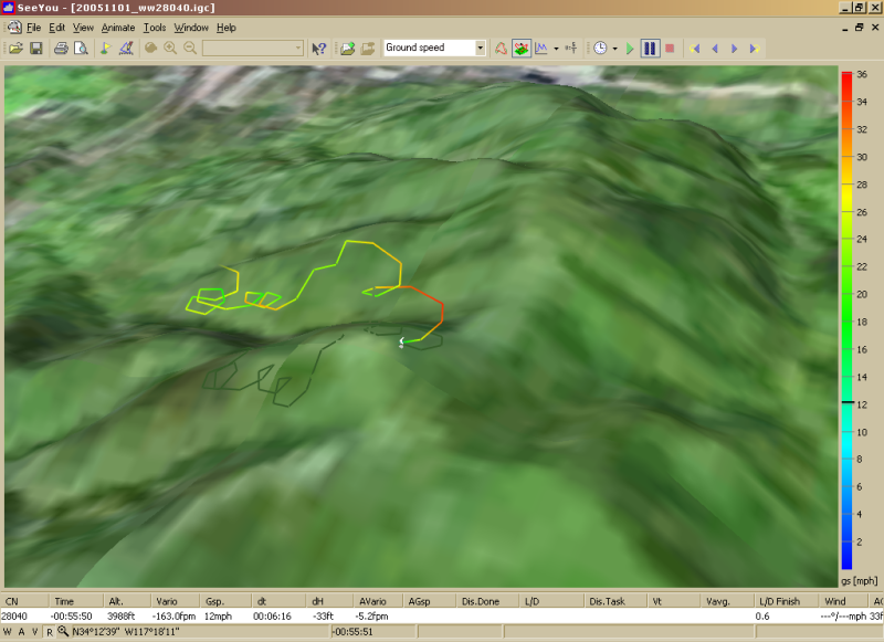
20051101: Top Land
Marshall (speed)
Marshall (speed)
800 x 581
(337 KB)
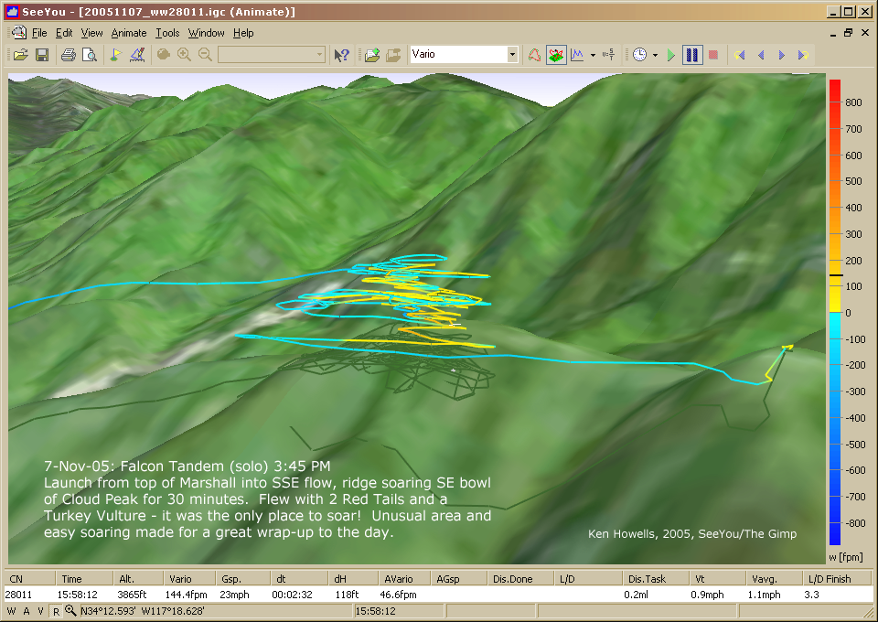
20051107: SE Launch
Marshall Peak
Marshall Peak
960 x 680
(526 KB)
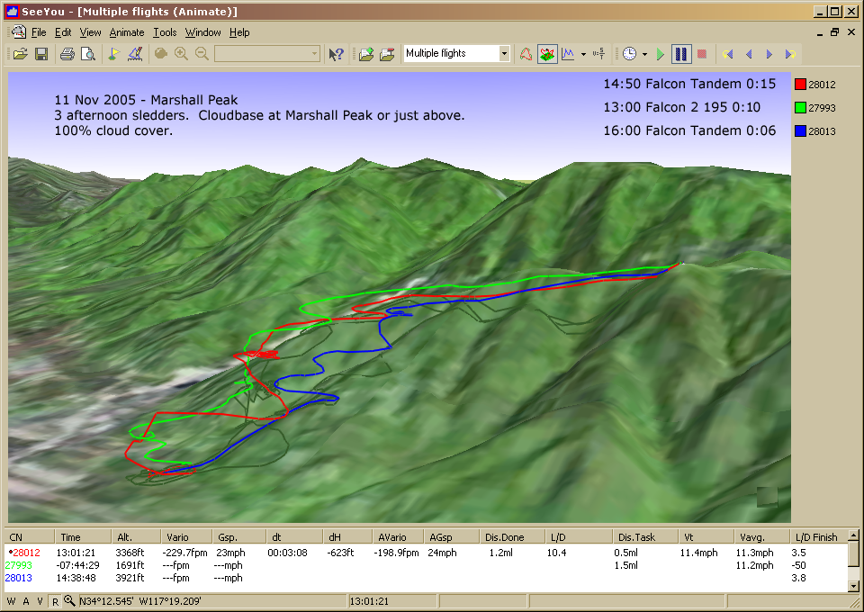
20051111: Marshall
3 Test Flights
3 Test Flights
960 x 680
(457 KB)
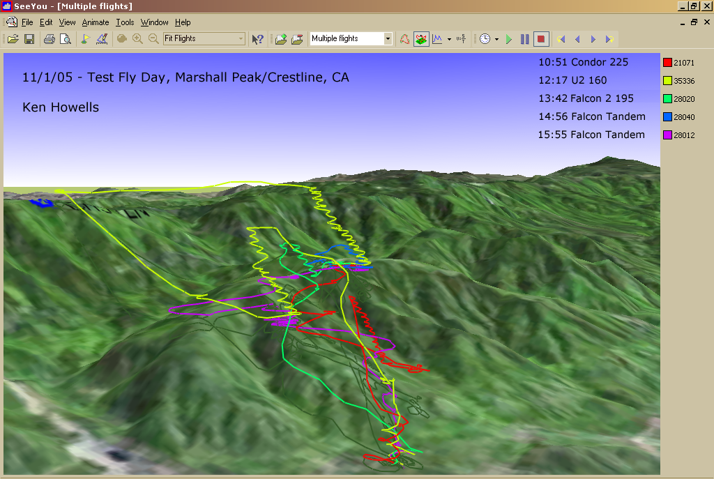
20051101: Marshall
5 Test Flights
5 Test Flights
1024 x 687
(571 KB)
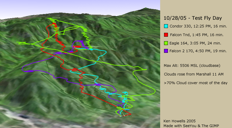
20051028: Marshall
4 Test Flights
4 Test Flights
775 x 429
(320 KB)
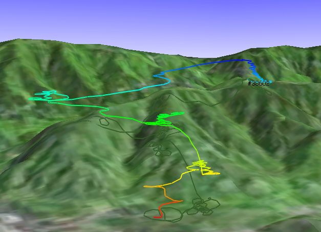
20051019: Marshall ww38602
627 x 453
(300 KB)