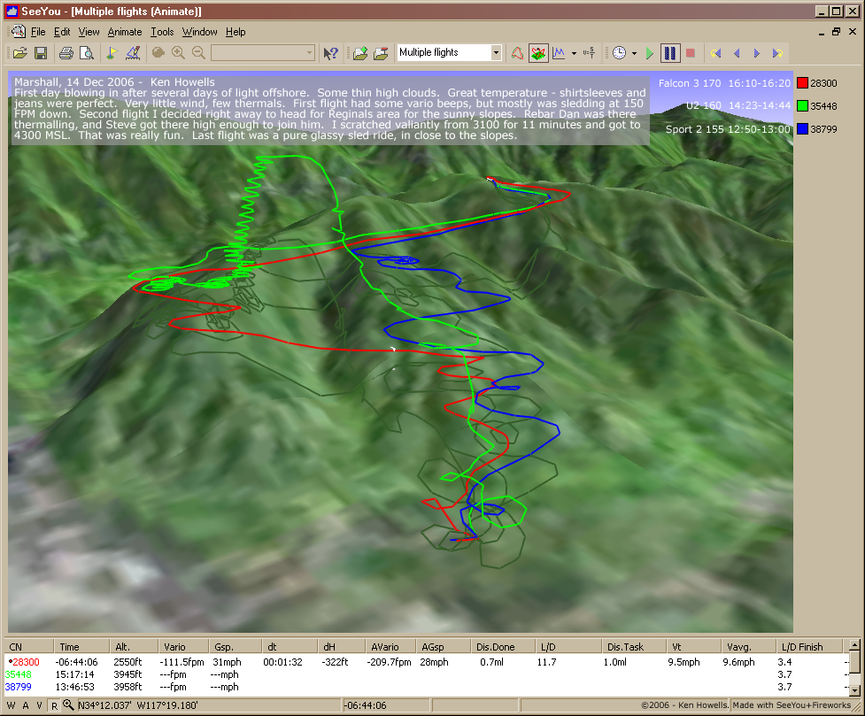
20061214: Marshall
977 x 809
(588 KB)
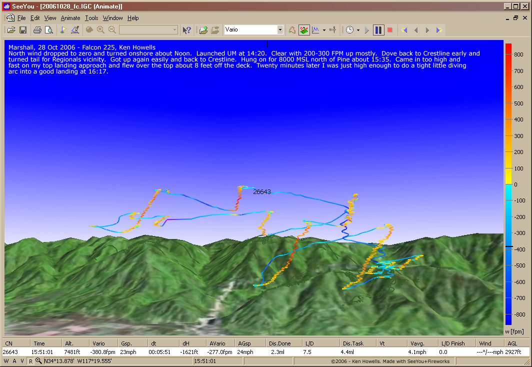
20061028: Marshall
1064 x 734
(590 KB)
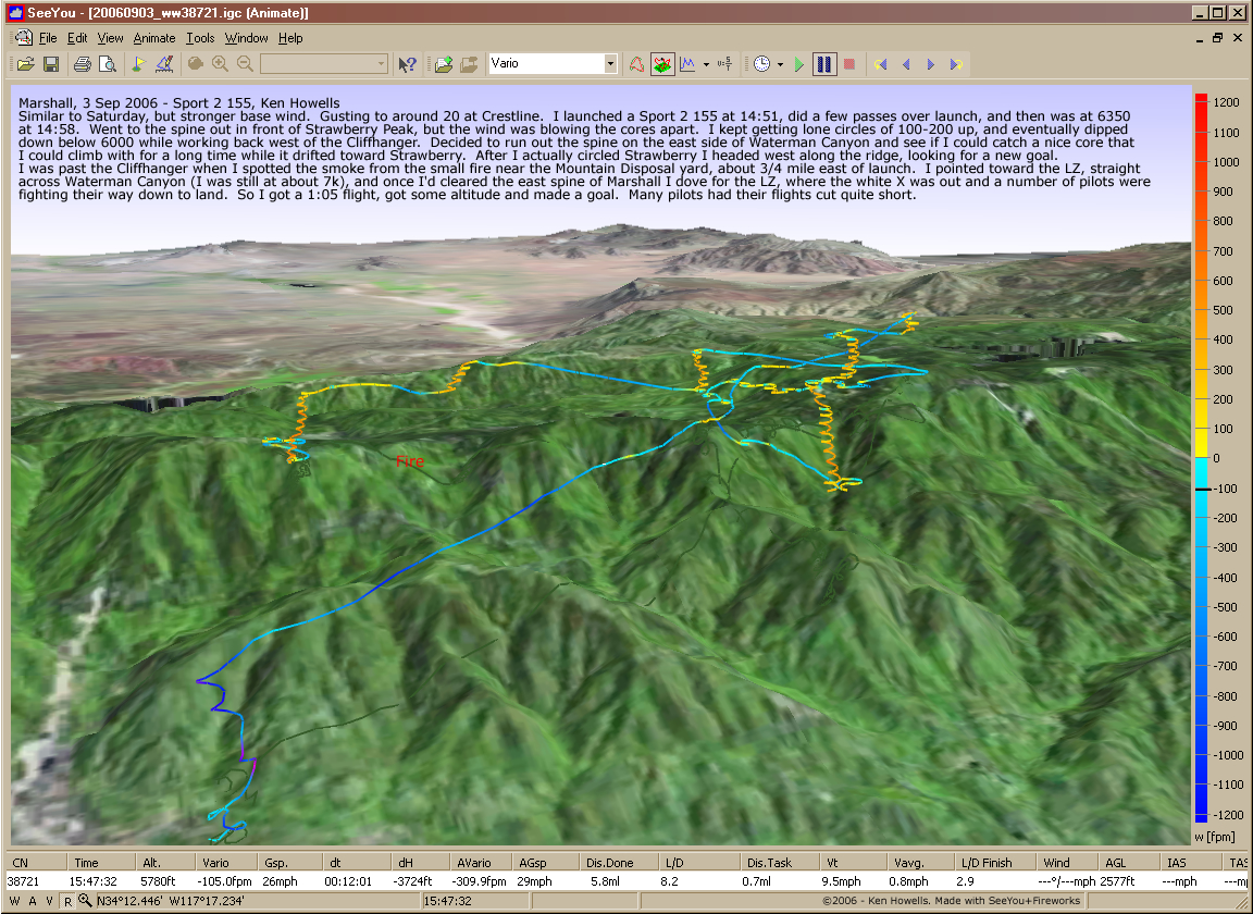
20060903: Crestline
1152 x 840
(852 KB)
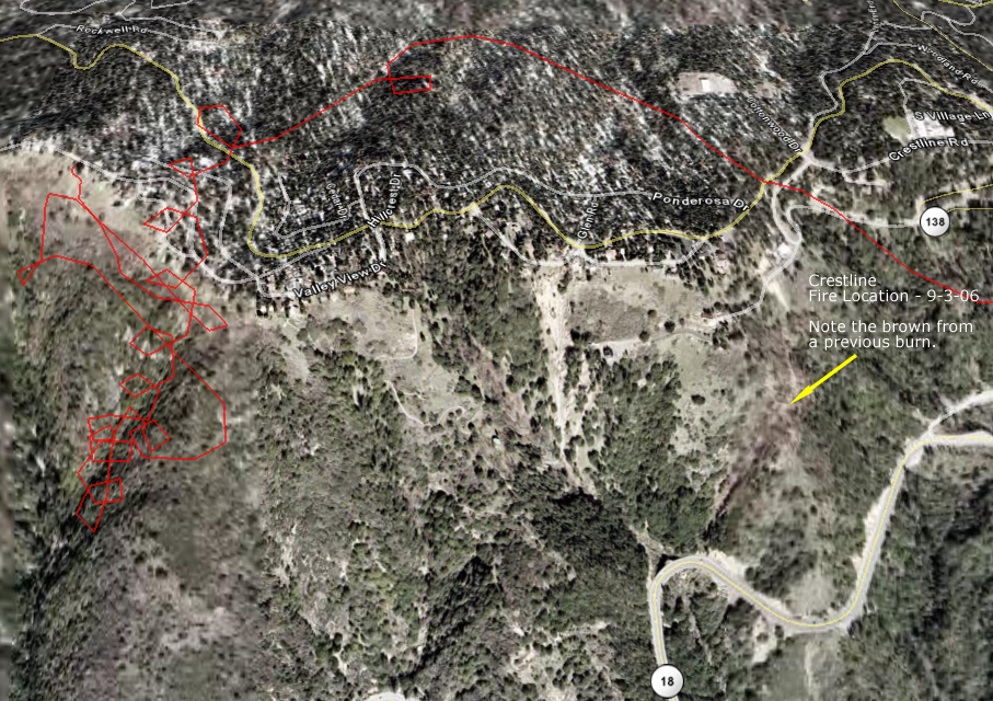
20060903: Fire Location (GE)
907 x 640
(520 KB)
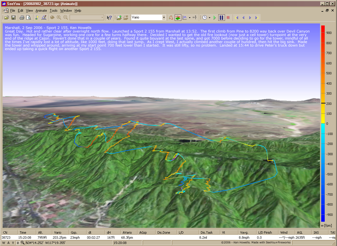
20060902: Marshall
1152 x 840
(852 KB)
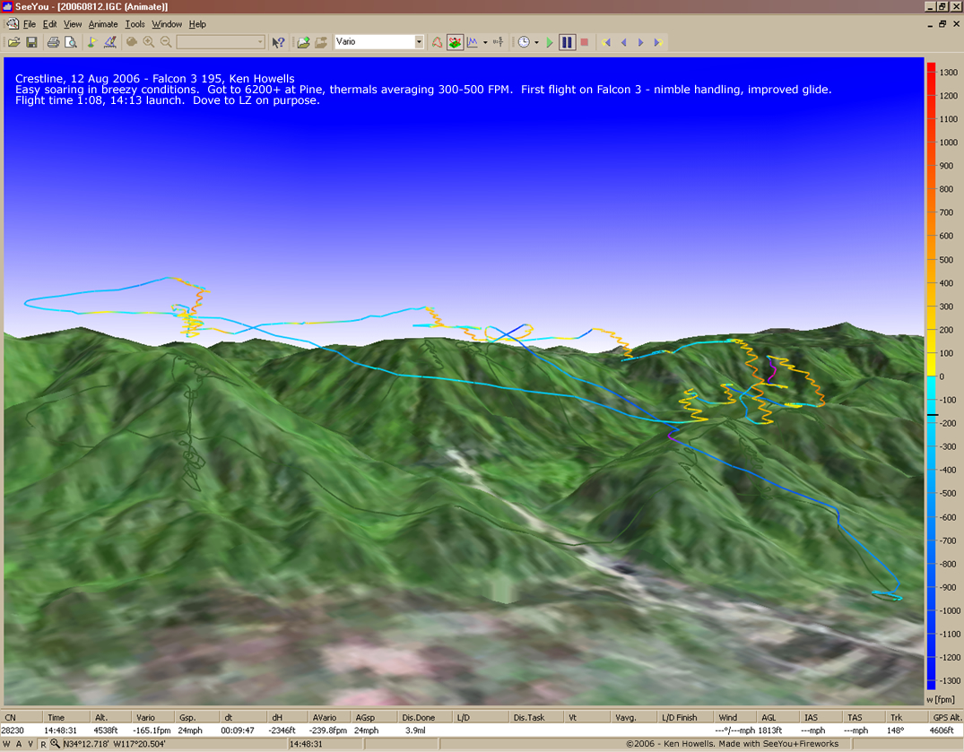
20060812: Crestline
1075 x 839
(633 KB)
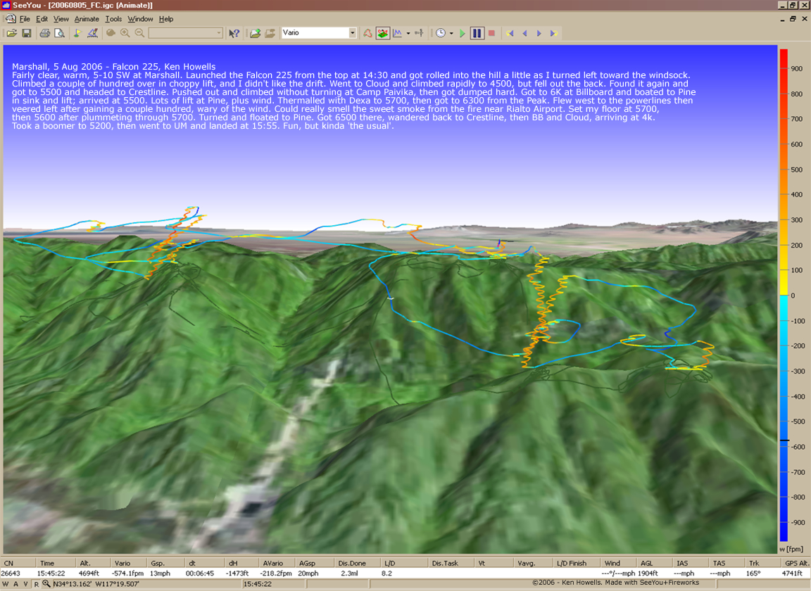
20060805: Marshall
1152 x 840
(767 KB)
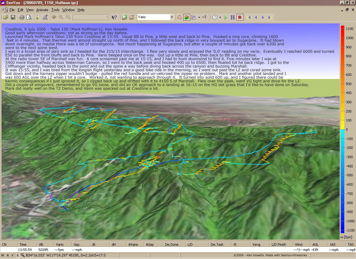
20060709: Crestline,
Mark's T150
Mark's T150
1152 x 840
(833 KB)
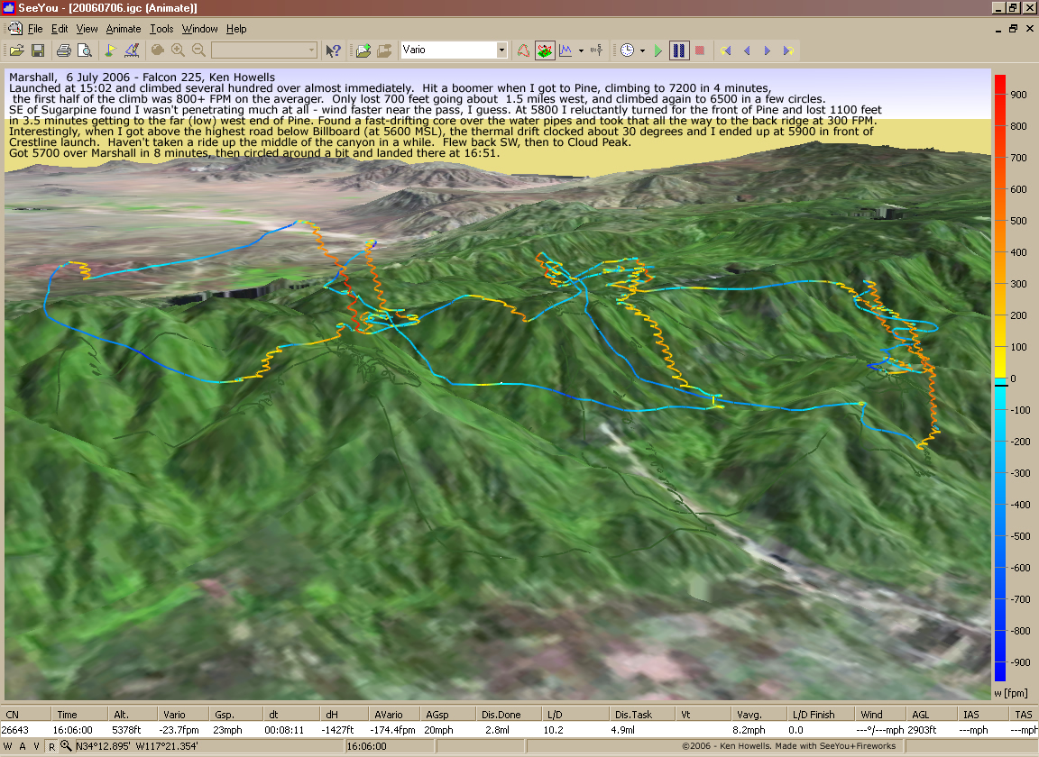
20060706:
Marshall
SeeYou - FPM
SeeYou - FPM
1152 x 840
(948 KB)

20060706:
Marshall
Google Earth
Google Earth
975 x 580
(679 KB)
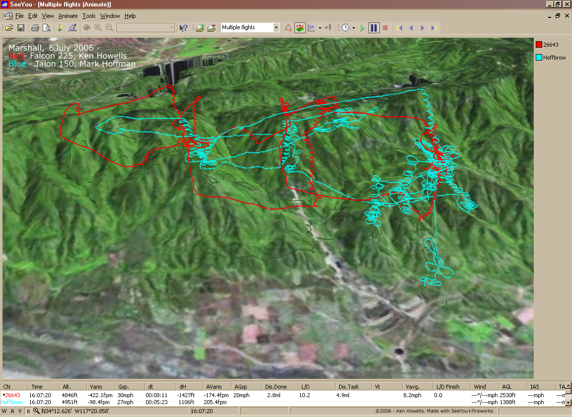
20060706:
Marshall
Howells - Hoffman
Howells - Hoffman
1152 x 840
(948 KB)

20060701:
Marshall
1152 x 840
(865 KB)
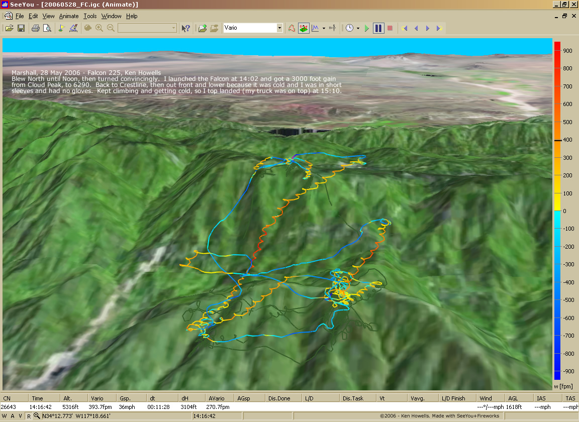
20060528:
Marshall
1152 x 840
(321 KB)

20060520:
Marshall
1152 x 840
(258 KB)
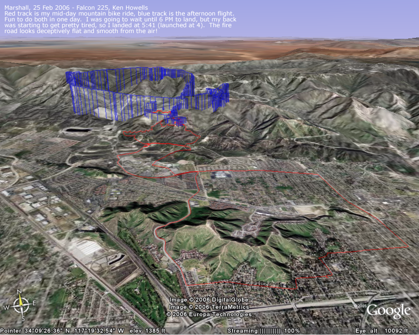
20060520:
Ride & Flight
861 x 960
(973 KB)

20060507:
Crestline
1152 x 840
(708 KB)
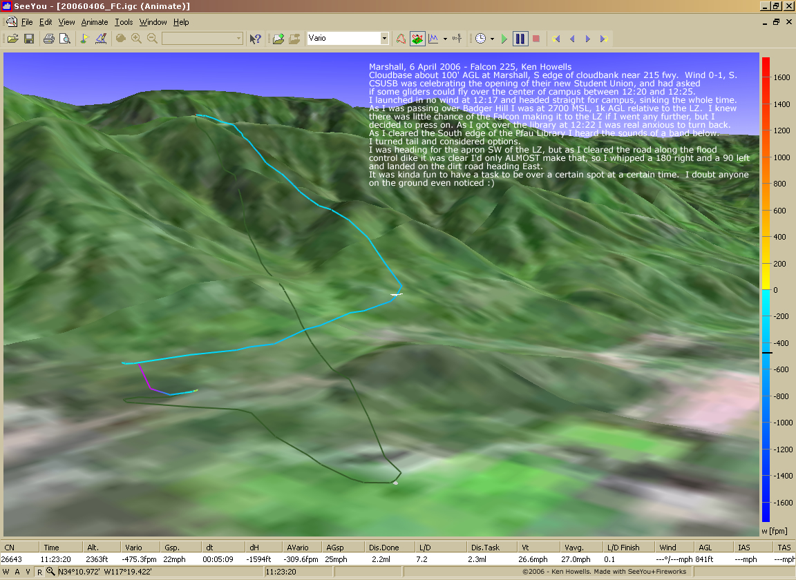
20060406:
Marshall
CSUSB Fly-over
CSUSB Fly-over
1152 x 840
(552 KB)
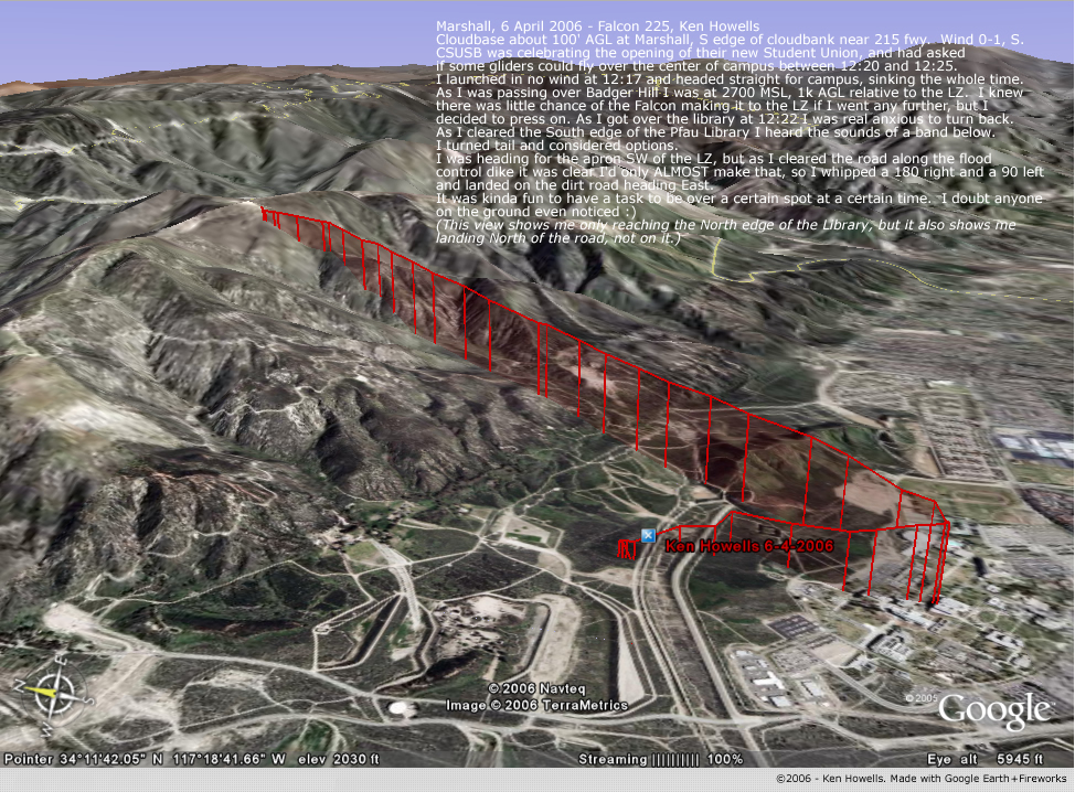
20060406:
Marshall
CSUSB Fly-over, Google Earth
CSUSB Fly-over, Google Earth
974 x 718
(610 KB)
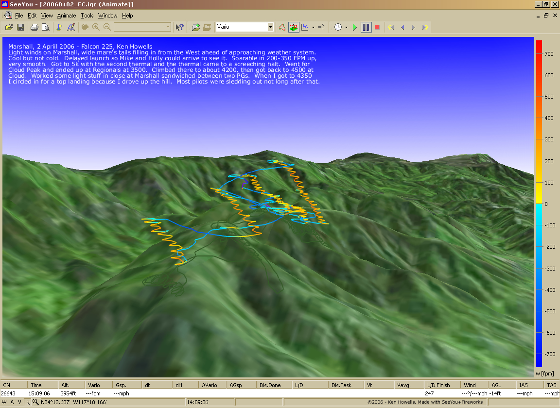
20060402:
Marshall
1152 x 840
(795 KB)
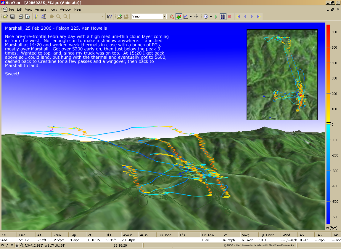
20060225:
Marshall
1052 x 840
(638 KB)
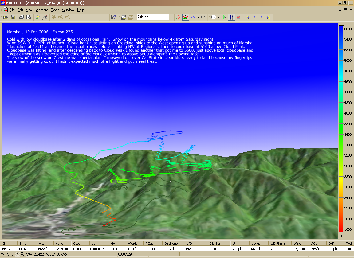
20060219:
Marshall
1024 x 744
(530 KB)

20060204:
Marshall
1024 x 744
(1.08 MB)
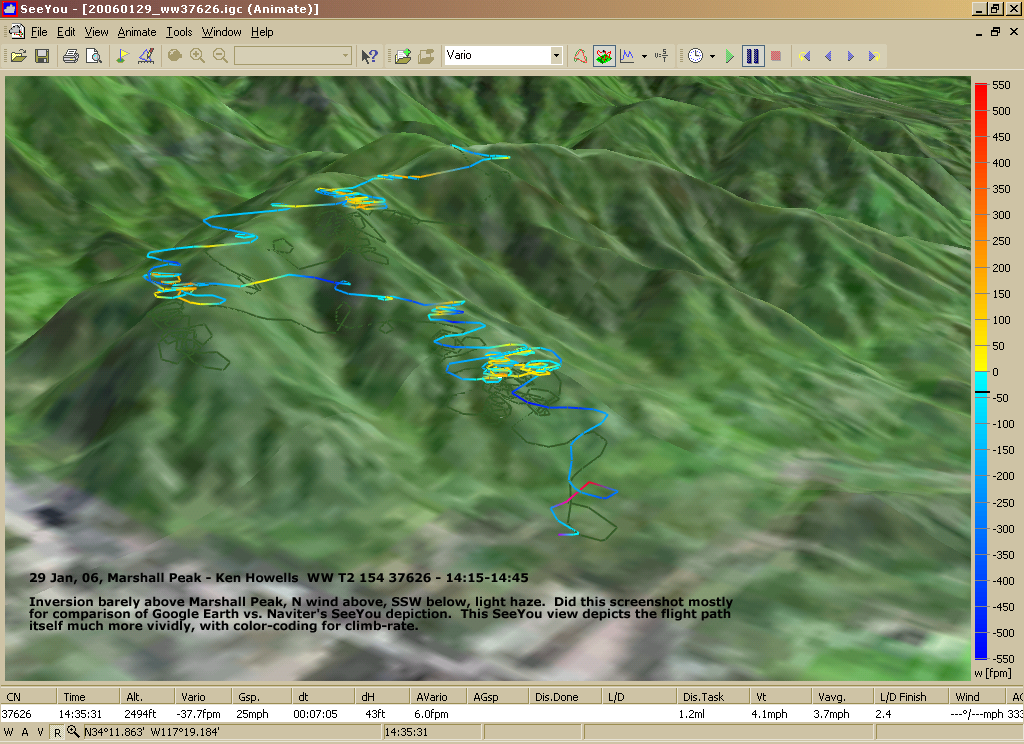
20060129:
Marshall
SeeYou
SeeYou
1024 x 744
(1.08 MB)

20060129:
Marshall
Google Earth
Google Earth
847 x 597
(1.2 MB)

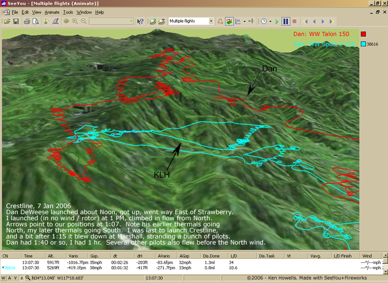
20060111: 3 Flights,
Marshall
Marshall
989 x 702
(930 KB)
20060107: Switch to Offshore
767 x 559
(693 KB)