
20071216: Marshall
1055 x 708
(523 KB)
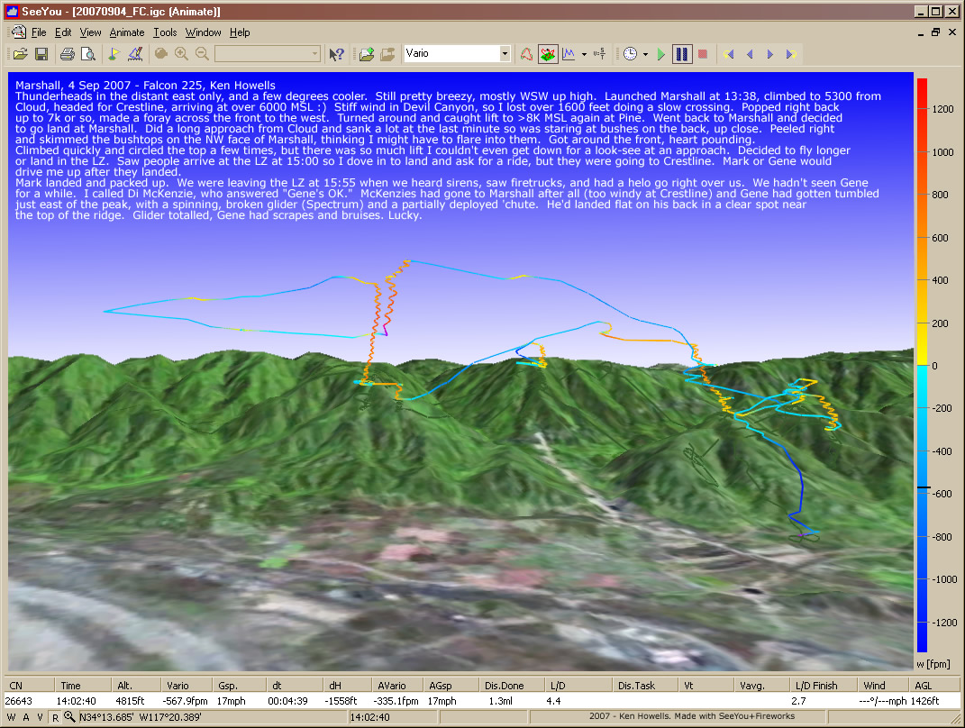
20070904: Marshall
1071 x 808
(312 KB)
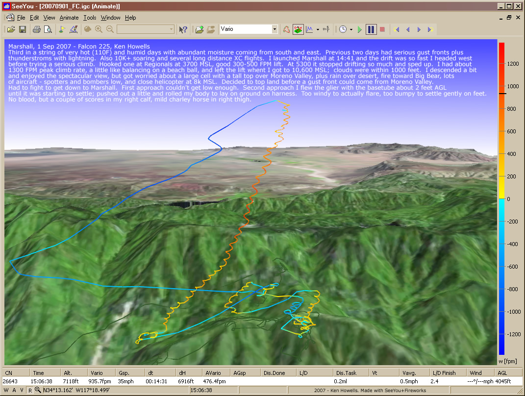
20070901: Marshall
1071 x 808
(330 KB)
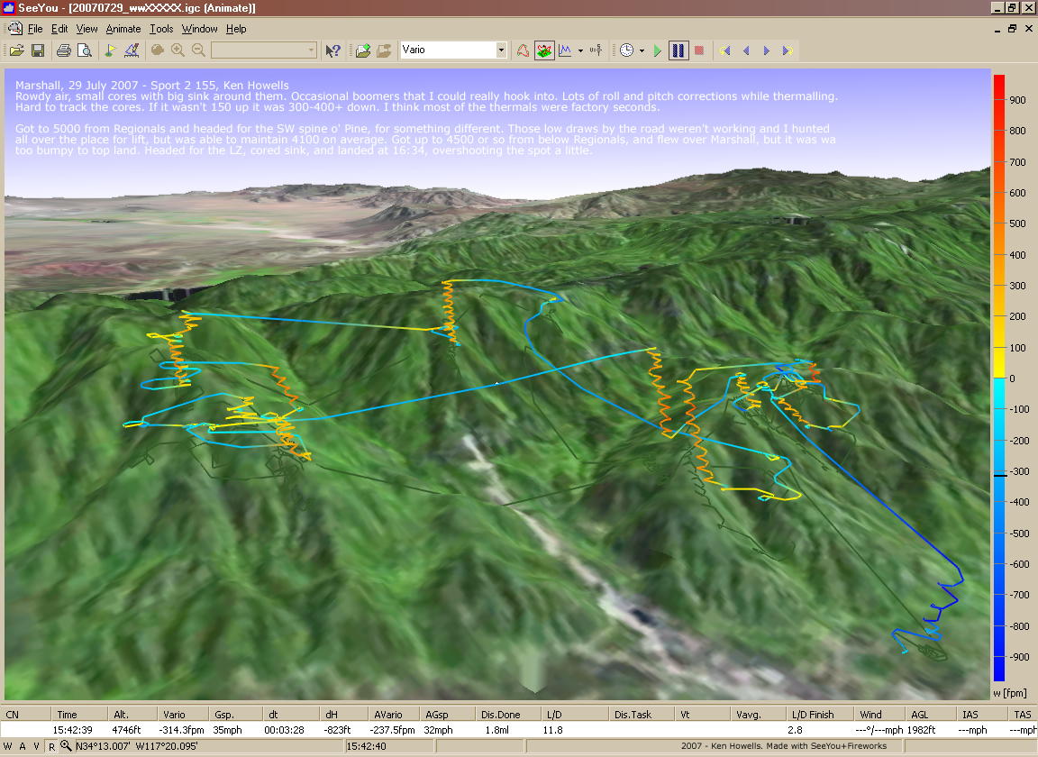
20070729: Marshall
1152 x 840
(667 KB)
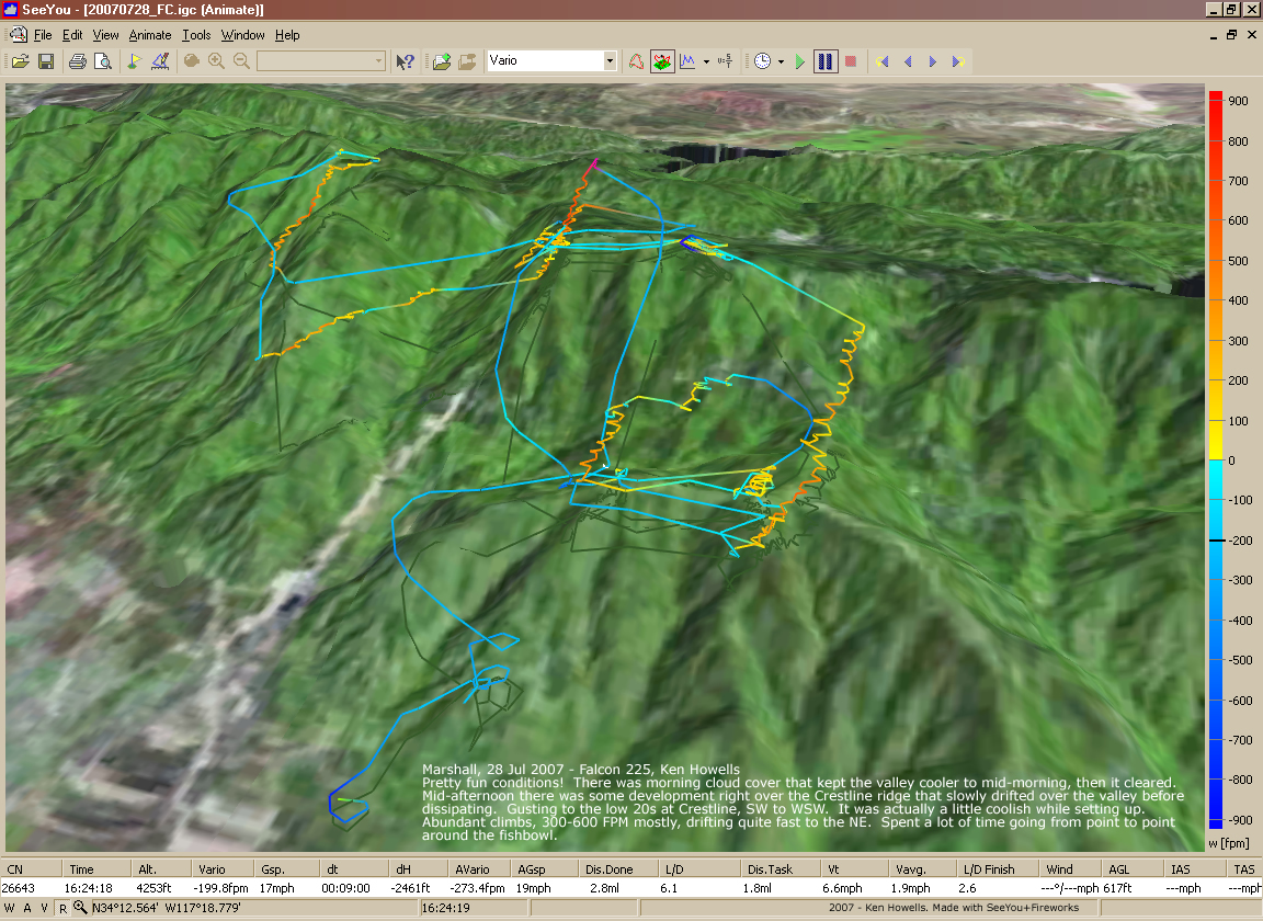
20070728: Crestline
1152 x 840
(689 KB)
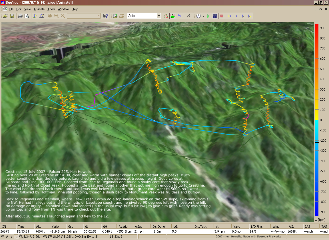
20070715: Crestline to Marshall
1152 x 840
(749 KB)
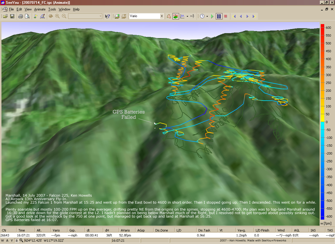
20070714: Marshall (Fly-In)
1152 x 840
(573 KB)
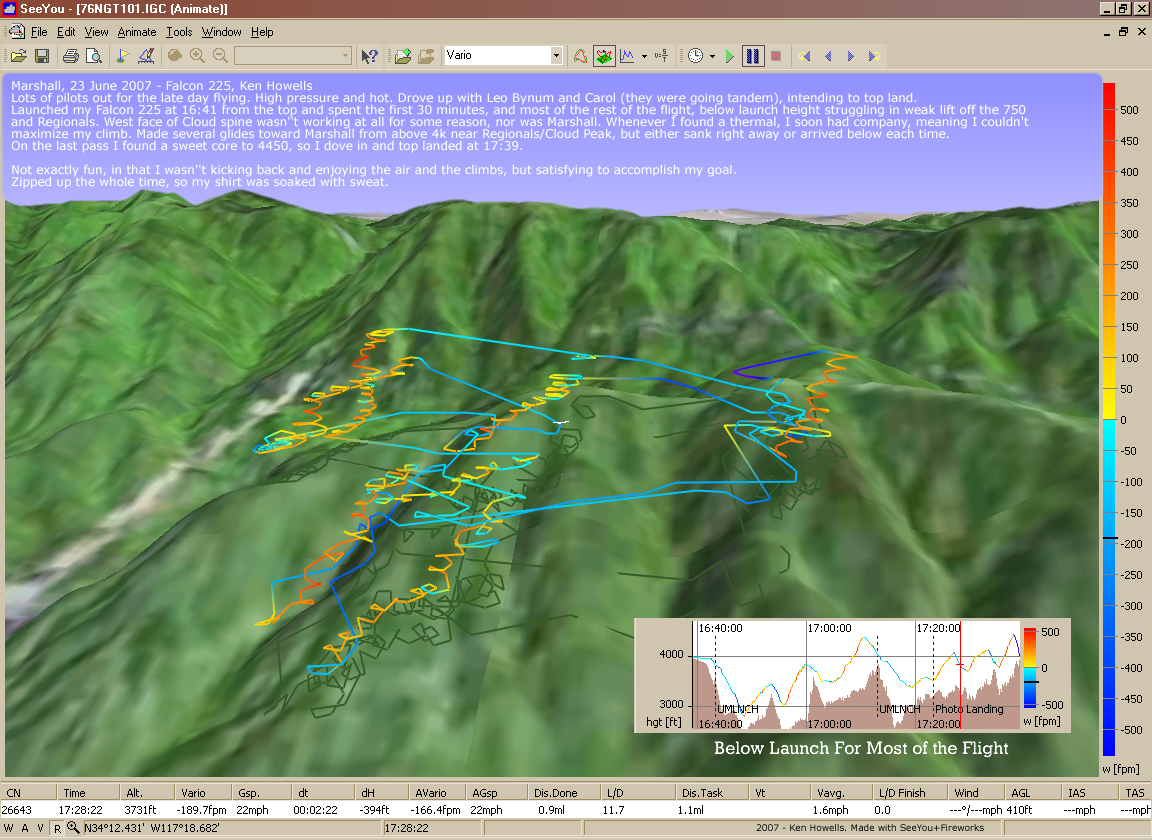
20070623: Marshall
1152 x 840
(660 KB)
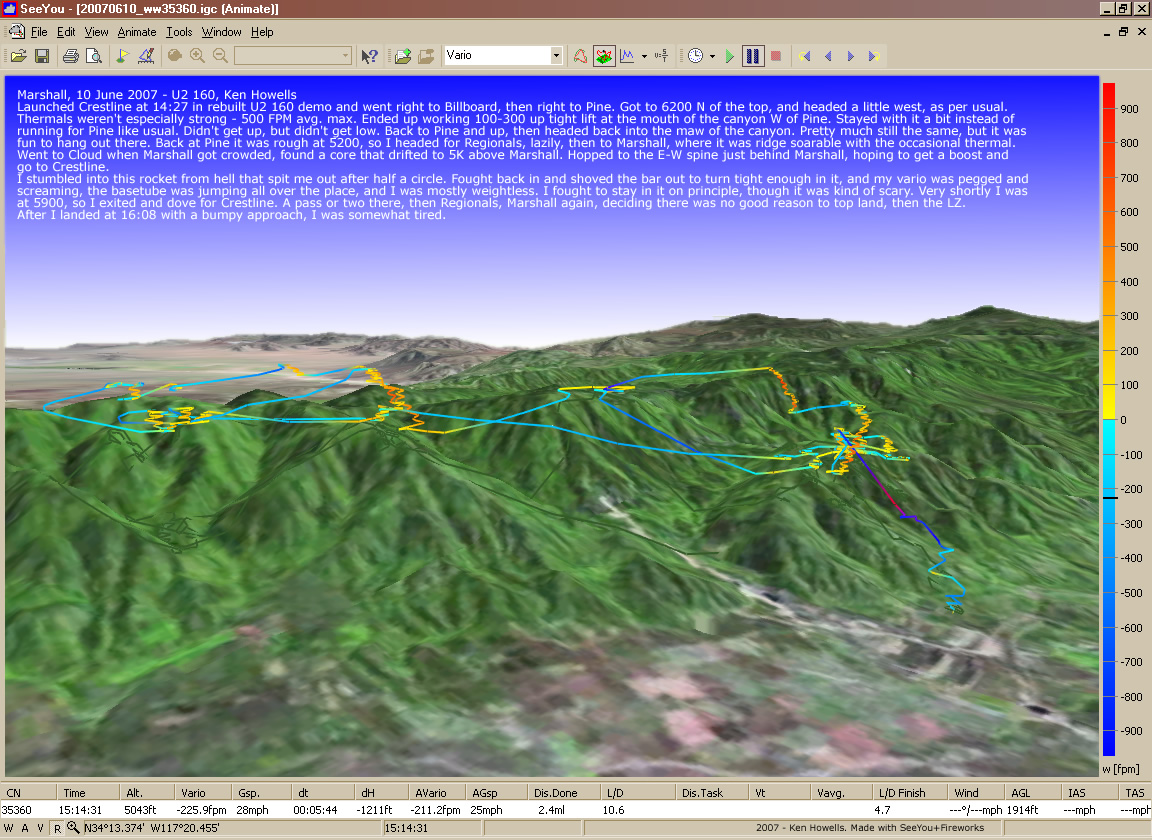
20070610: Crestline
1152 x 840
(401 KB)
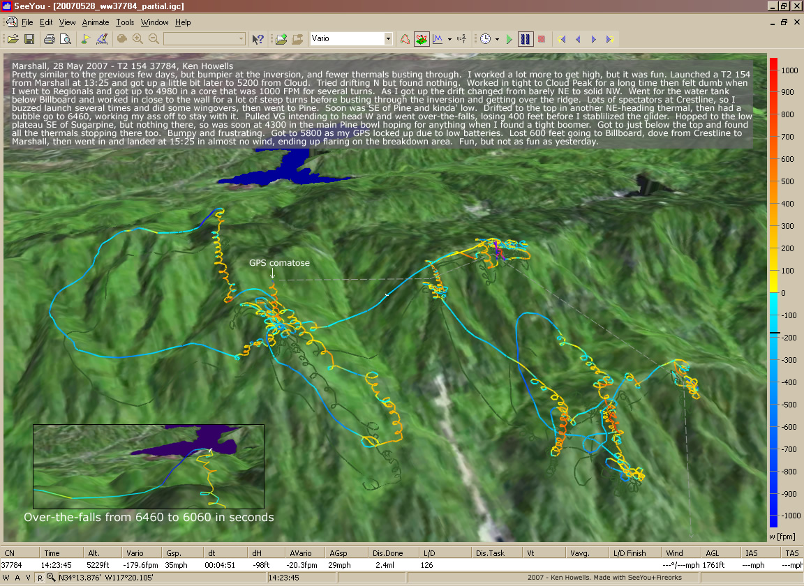
20070528: Marshall
1152 x 840
(409 KB)
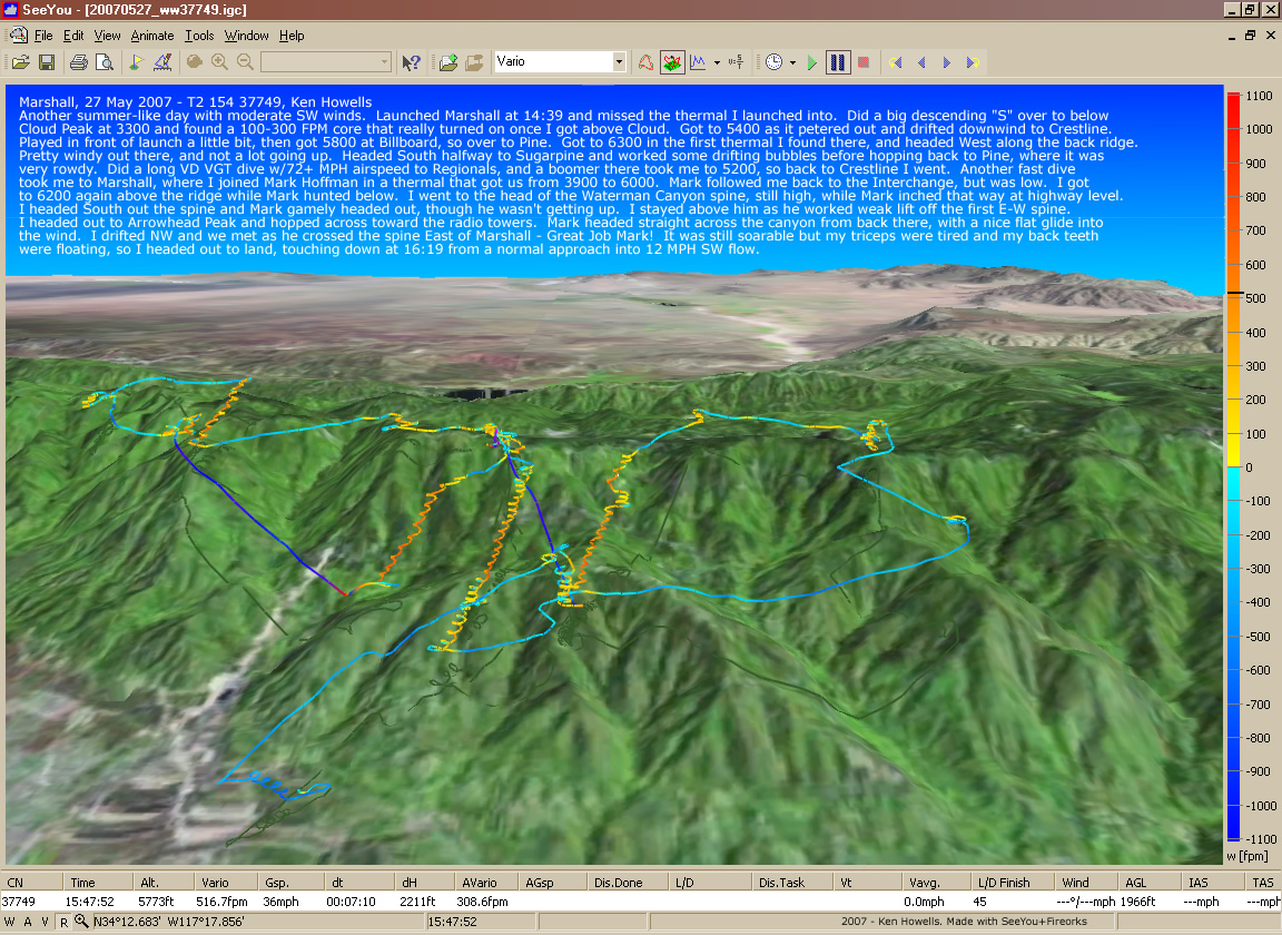
20070527: Marshall
1152 x 840
(526 KB)
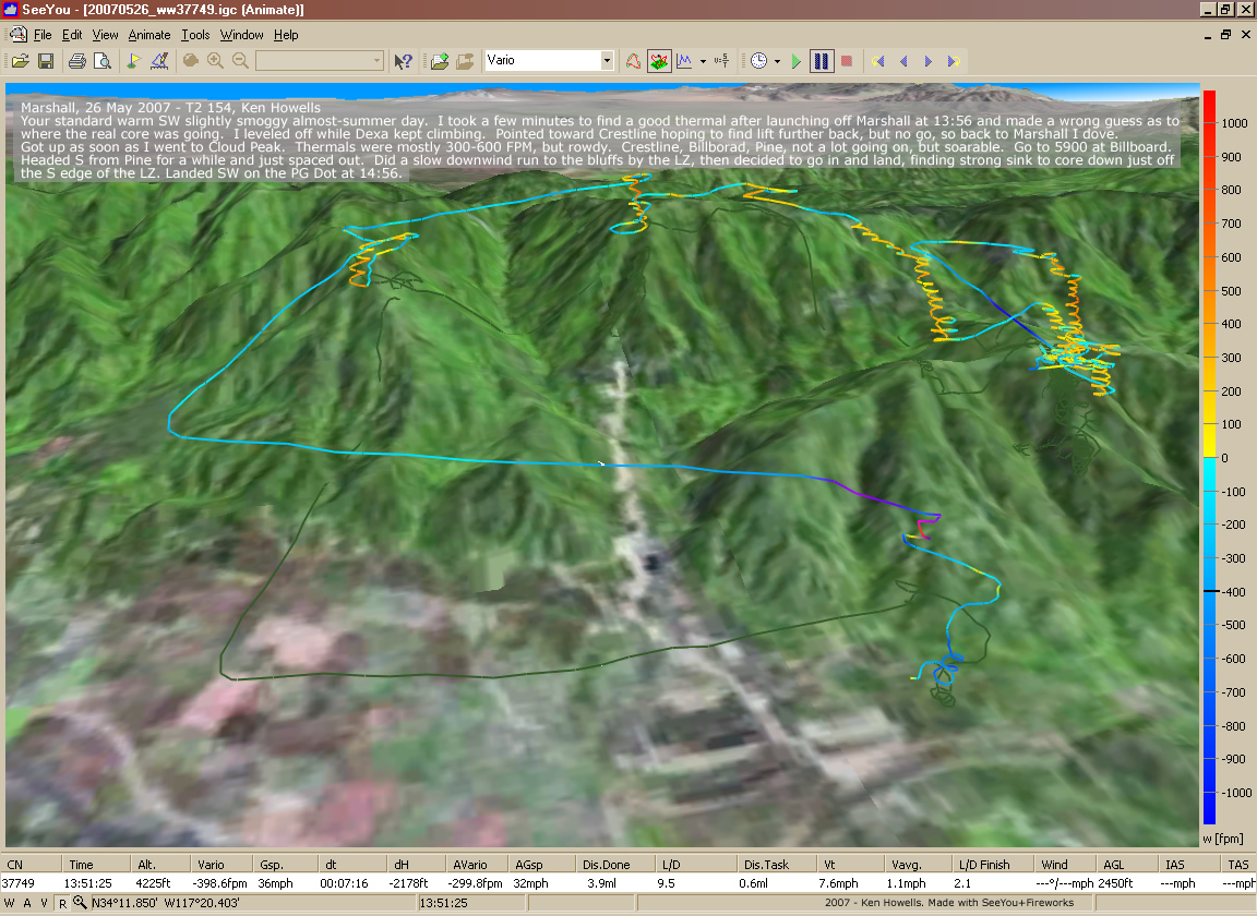
20070526: Marshall
1152 x 840
(378 KB)
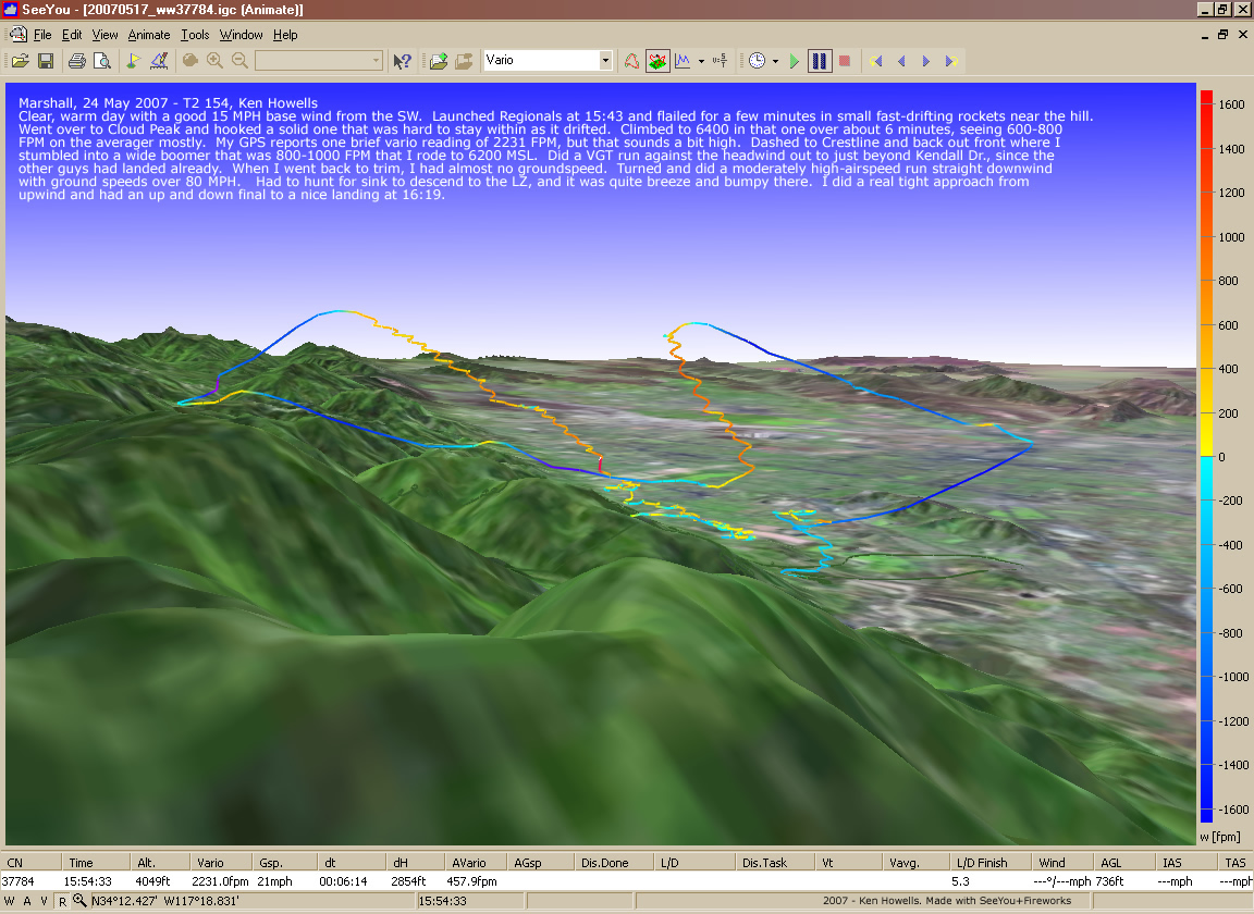
20070524: Regionals
1152 x 840
(387 KB)
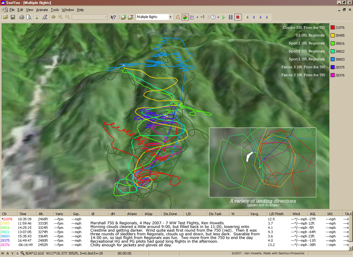
20070502: Marshall
750 & Regionals - 7 flights
750 & Regionals - 7 flights
1152 x 840
(260 KB)
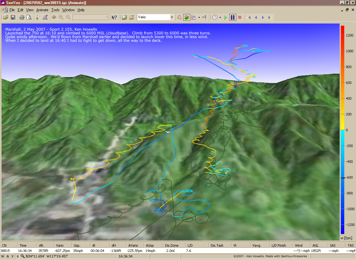
20070502: Marshall
"The 750" to 6k
"The 750" to 6k
1152 x 840
(253 KB)
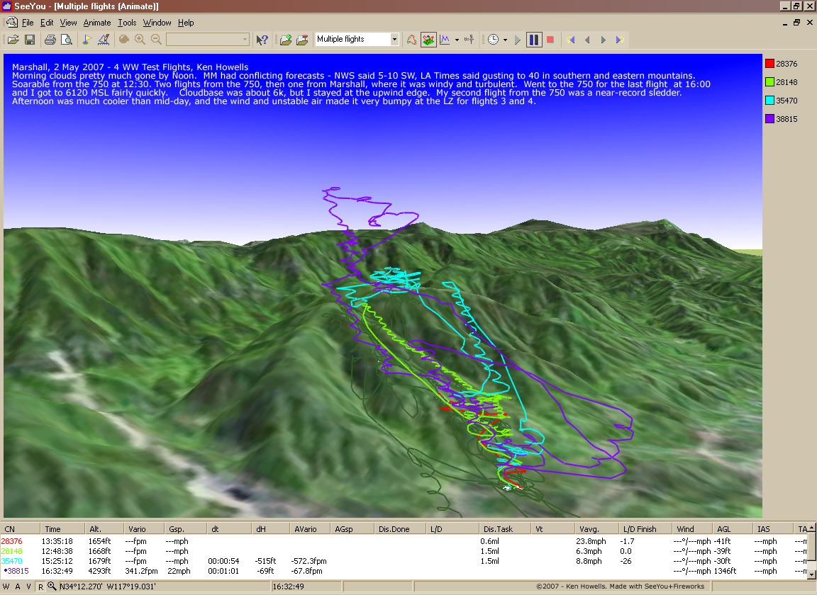
20070502: Marshall
4 flights
4 flights
1152 x 840
(301 KB)
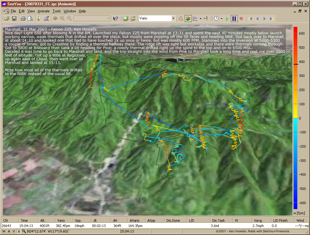
20070331: Marshall
1002 x 761
(574 KB)

20070306: Marshall 5 Flights
952 x 740
(481 KB)

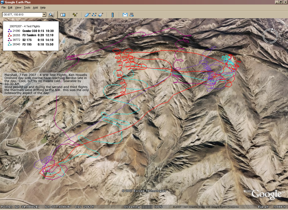
20070218: Cross Eyed Stereo -Google Earth
800 x 600
(560 KB)
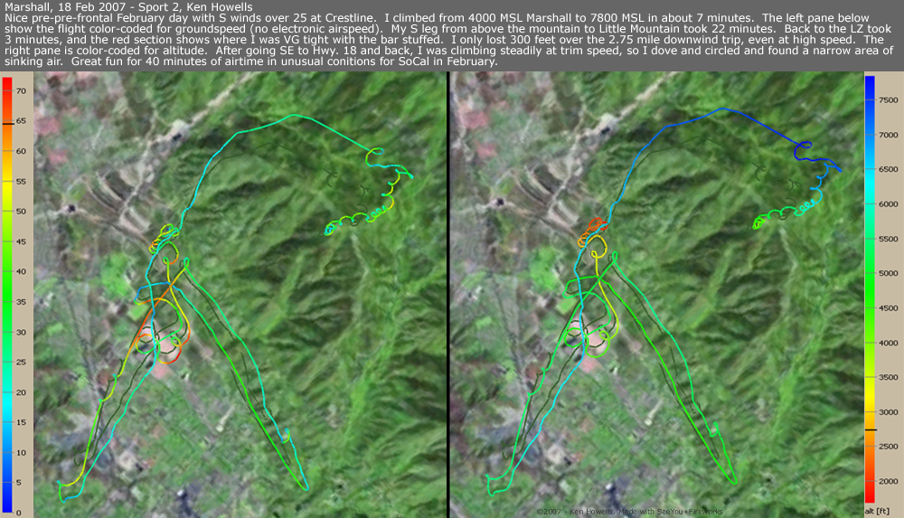
20070218: Marshall Windy
1000 x 573
(469 KB)
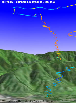
20070218: Marshall Climb
300 x 405
(25 KB)
20070207: Marshall 4 Flights
1152 x 840
(853 KB)
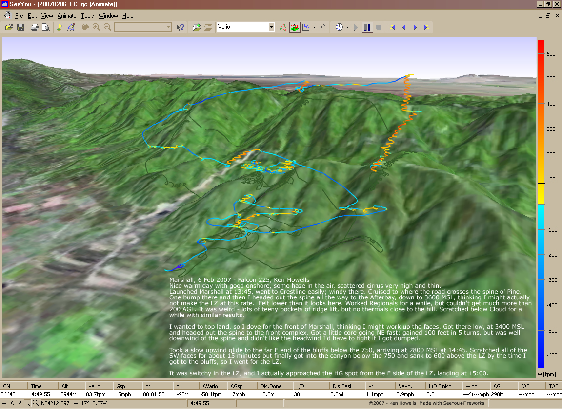
20070206: Marshall
1152 x 840
(707 KB)
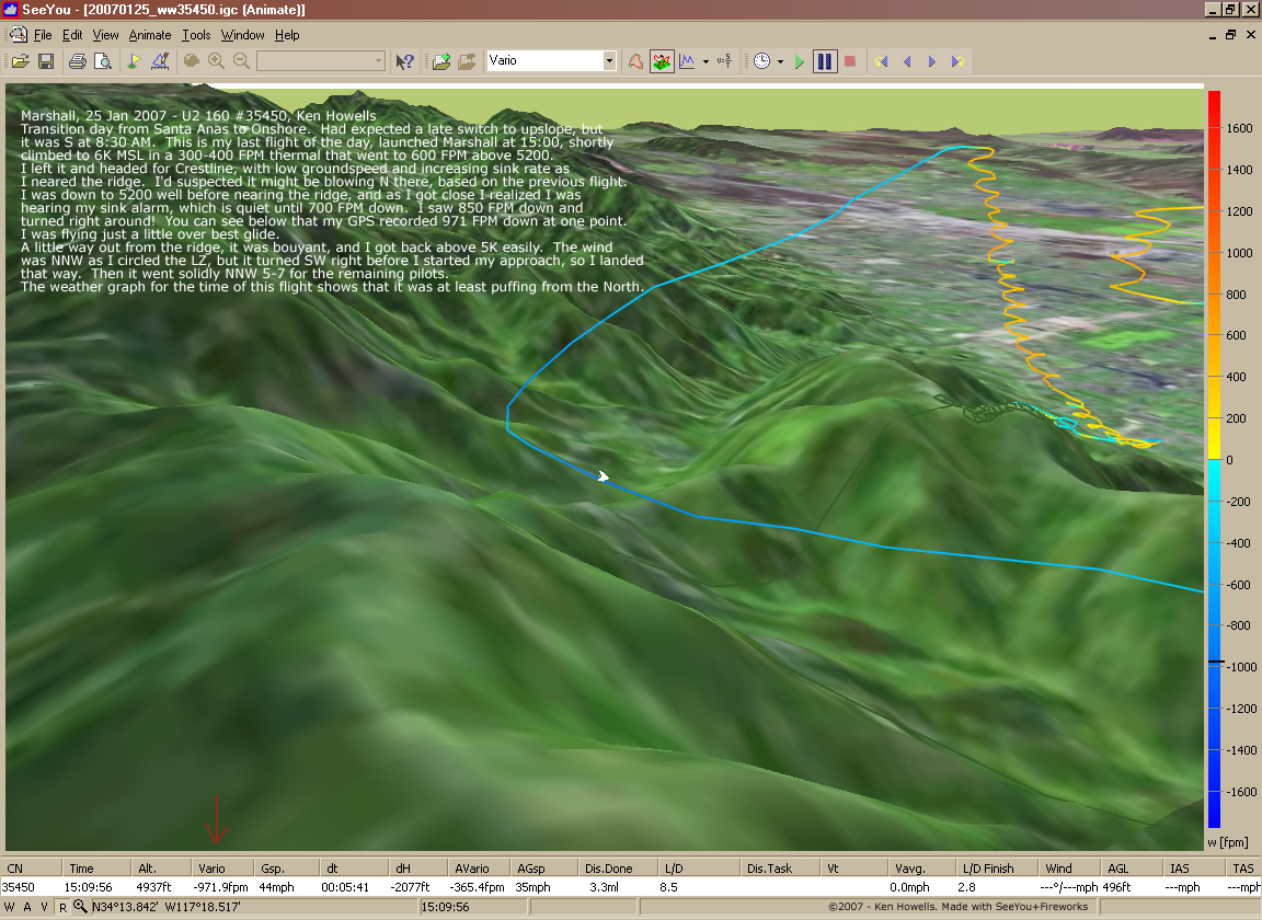
20070125: Marshall - U2 Sink Detail
1152 x 840
(312 KB)
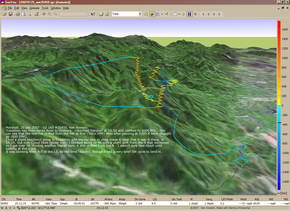
20070125: Marshall - U2 N Switch
1152 x 840
(338 KB)
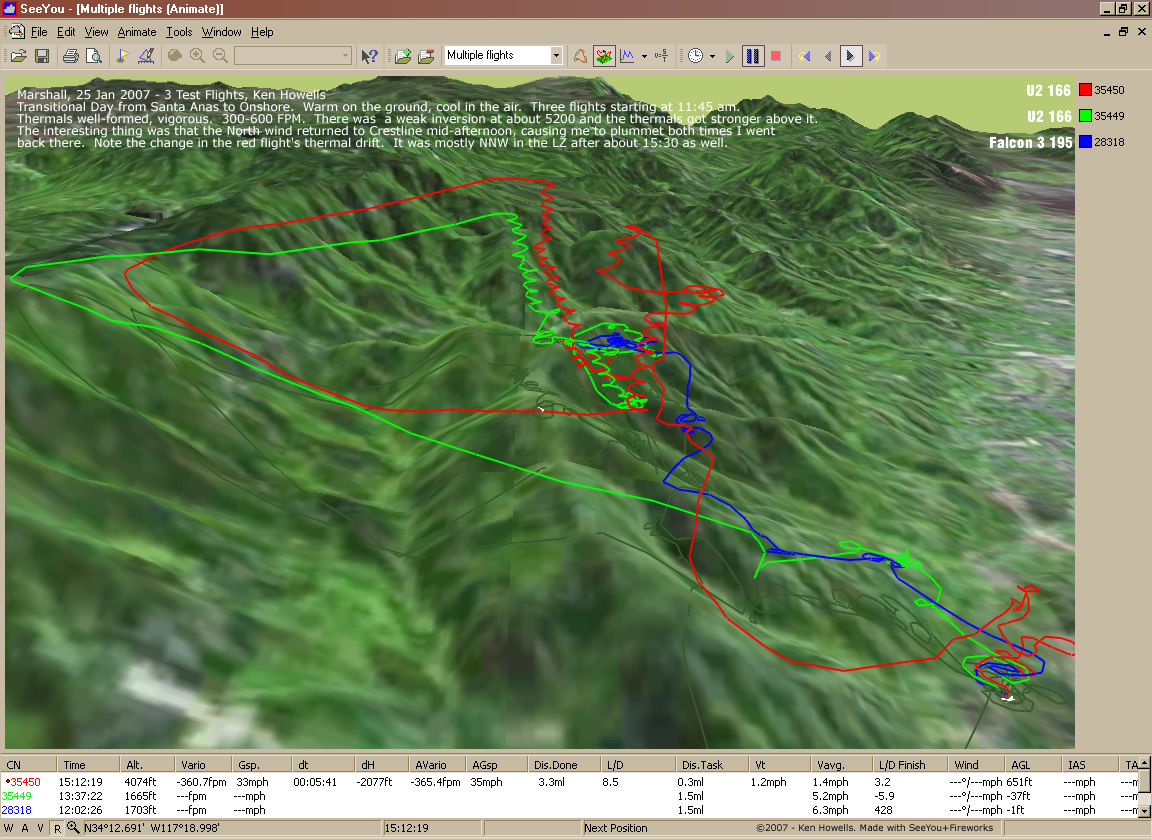
20070125: Marshall - 3 Flights
1152 x 840
(341 KB)