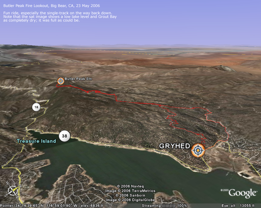
20060523: Butler Peak Fire Lookout
860 x 686
(488 KB)
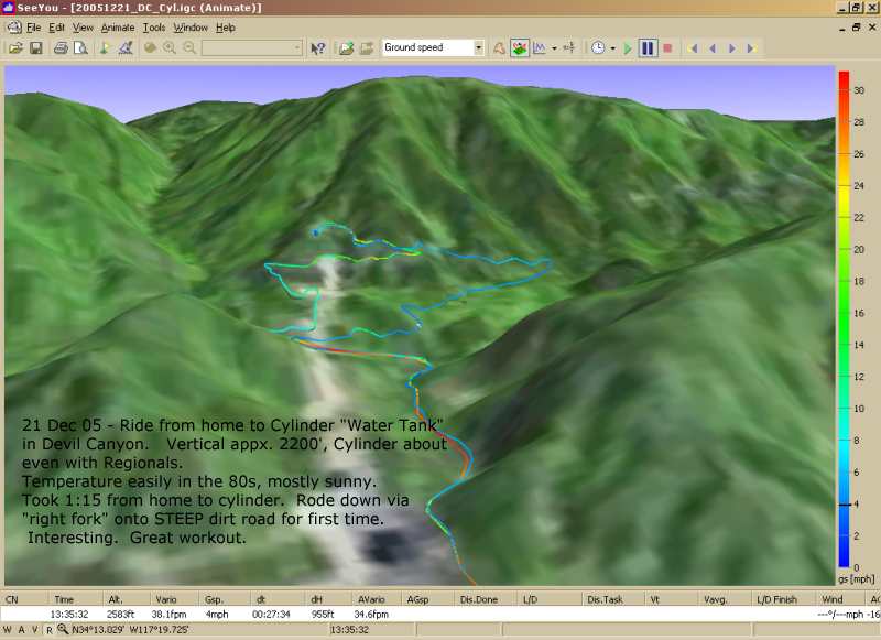
20051221: Devil
Cyn. Cylinder
Cyn. Cylinder
800 x 581
(520 KB)
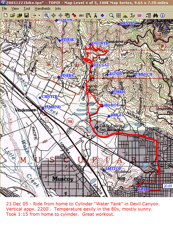
20051221: Devil
Cyn. Cylinder
(topo)
Cyn. Cylinder
(topo)
567 x 744
(707 KB)
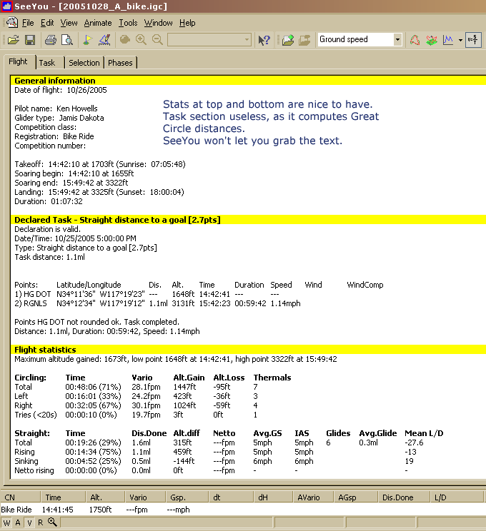
20051028_A_stats_LZ2Rgnls.png
680 x 744
(30 KB)
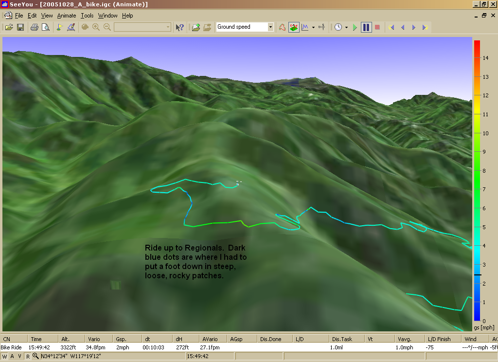
20051028_A_upToRegionals.png
1024 x 744
(705 KB)
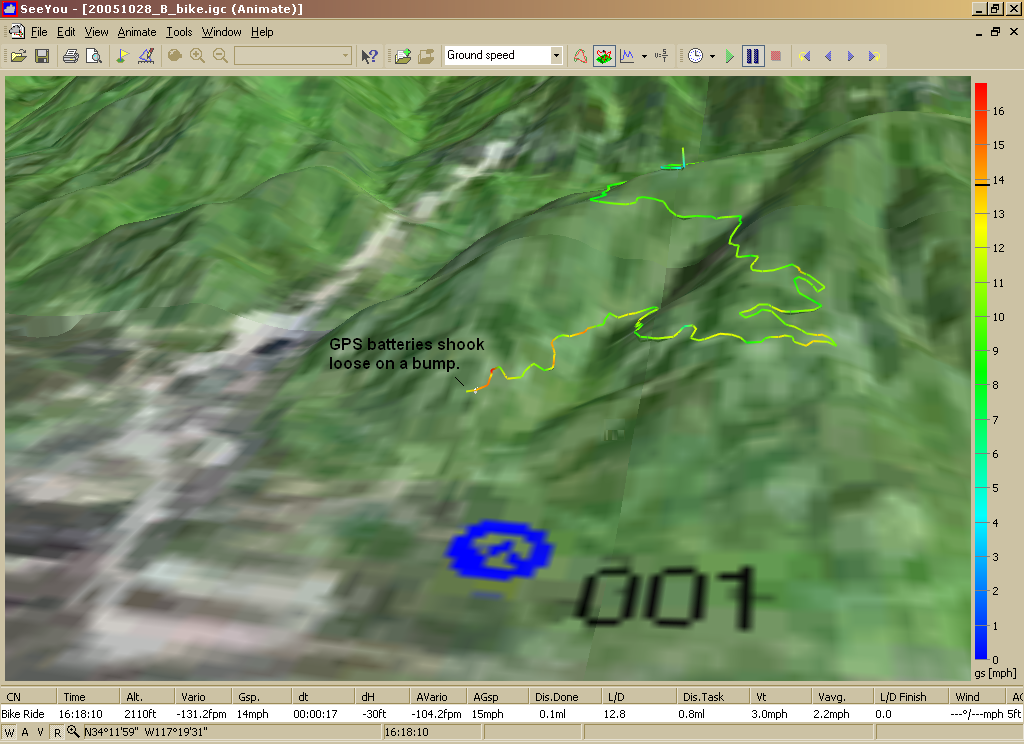
20051028_B_downFromRegionals.png
1024 x 744
(927 KB)
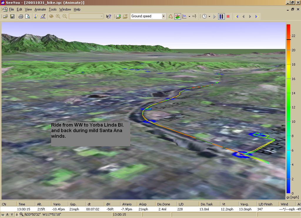
20051031_3d_ww_ylriv_back.png
1024 x 744
(997 KB)

20051031_graph-gspd_ww_ylriv_back.png
1024 x 744
(56 KB)
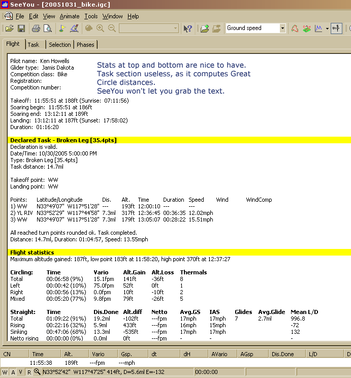
20051031_stats_ww_ylriv_back.png
691 x 744
(31 KB)

20051031_ww_ylriv_back_2d.png
1024 x 744
(425 KB)